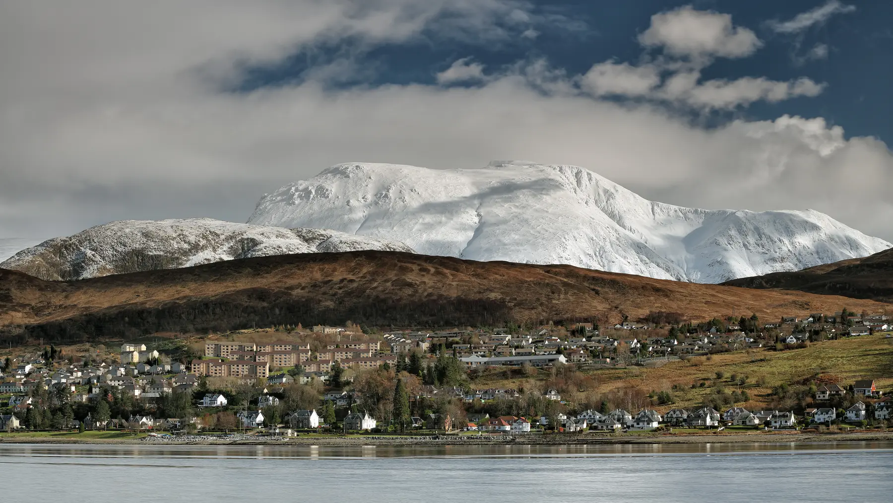
Fort William sits at the junction of the Great Glen and the west coast, which makes it the best base in the western Highlands. Glen Coe is twenty minutes south. The Road to the Isles runs west to Mallaig and the Skye ferry. The A82 runs north-east up the Great Glen to Loch Ness and Inverness. Oban is an hour and a half south, Skye two hours north-west.
Two warnings about Highland driving. Distances are deceptive — single-track sections, passing places and slow traffic mean a hundred kilometres can take two hours. And the roads are spectacular, so the driving is part of the day rather than an interruption to it.
Twenty minutes down the A82, and one of the most famous landscapes in Britain. The glen runs between the Three Sisters of Bidean nam Bian on one side and the Aonach Eagach ridge on the other, with waterfalls coming off both walls and the road climbing to Rannoch Moor at the top.
Stops, in order coming from Fort William: Glencoe village and the Lochan trails; the NTS visitor centre with its exhibition on the 1692 massacre and the glen’s geology; the Three Sisters viewpoint; the Meeting of Three Waters; the walk into the Lost Valley, a hidden corrie reached by a steep rocky hour; the Study viewpoint; and Rannoch Moor, a vast expanse of bog, lochans and nothing at all.
It can be a two-hour drive or a full day of walking. In poor weather it is better, not worse.
Kinlochleven, at the head of Loch Leven, has the Ice Factor climbing centre and is a stop on the West Highland Way.
The A830 runs forty-five miles from Fort William to Mallaig and it is one of the great drives in Scotland.
Twenty-one kilometres out. The Glenfinnan Monument at the head of Loch Shiel marks where Prince Charles Edward Stuart raised his standard in August 1745 and the rising began. Above it, the Glenfinnan Viaduct — twenty-one concrete arches on a curve — carries the West Highland Line, and the Jacobite steam train crossing it is one of the most photographed sights in Britain. There is a viewpoint on the hillside, a visitor centre and a station museum. Our Jacobite and Glenfinnan guide covers the timings.
Go early. The car parks fill long before the train is due.
Fifty kilometres out. The Silver Sands of Morar are a series of white shell-sand beaches with turquoise water and views to Eigg, Rum and Skye. On a clear day they are as good as anywhere in Britain. Loch Morar behind them is the deepest freshwater body in the country.
Sixty-five kilometres, and the end of the road and the railway. A working fishing port with seafood restaurants, and the ferry terminal for Skye (the short crossing to Armadale), the Small Isles and Knoydart — the latter being a peninsula with no road connection at all, reachable only by boat or a two-day walk.
A day trip to Mallaig by train and back is one of the best rail journeys in the world.
Spean Bridge and the Commando Memorial, thirteen kilometres out, with the best roadside view in the area.
Loch Lochy, Loch Oich and the canal, with Fort Augustus at the head of Loch Ness — an hour away, with a flight of canal locks in the middle of the village.
Loch Ness and Urquhart Castle are an hour and a quarter, and Inverness an hour and a half. It is a long day but a straightforward one, and the drive up the Great Glen is easy going by Highland standards.
The Corran Ferry, thirteen kilometres south, crosses Loch Linnhe in five minutes and opens up a peninsula most visitors never reach. Ardnamurchan Point is the most westerly point on the British mainland, with a lighthouse and a two-hour drive of single-track road to reach it. Sanna Bay beyond it is one of the finest beaches in Scotland and almost always empty.
It is a full day and the roads are slow. It is also the best day out from Fort William if you want to get away from other people.
Oban is an hour and a half south, a Victorian resort with a working ferry port, a distillery, and boats to Mull, Iona and the Outer Hebrides. Castle Stalker, the castle on an island in Loch Laich that appears in Monty Python and the Holy Grail, is on the way.
Two routes. The Mallaig–Armadale ferry from the end of the Road to the Isles, or the road north via Invergarry and the Skye Bridge, around two hours. Skye deserves several days rather than one, but the Sleat peninsula and Armadale are doable as a long day from Fort William.
Better than you would expect. The West Highland Line runs west to Glenfinnan, Arisaig and Mallaig with several services a day, which covers the Road to the Isles entirely; and south to Crianlarich, where the line divides for Oban and Glasgow. Trains from Glasgow Queen Street take four hours, with five daytime services Monday to Saturday and two on Sunday. The Caledonian Sleeper runs overnight from London Euston, arriving mid-morning.
Buses run south to Glencoe and Kinlochleven, north to Inverness, and west along the Road to the Isles. Coach tours out of Fort William cover Glen Coe, Skye and Loch Ness for those who do not want to drive.
How to reach the town itself is on the getting here page.
The Glen Coe half day. South on the A82 to Glencoe village, the Lochan trails, then up the glen with stops at the visitor centre, the Three Sisters and the Meeting of Three Waters, turning at Rannoch Moor. Two to three hours of driving with stops, or a full day if you walk into the Lost Valley.
The Road to the Isles full day. West to Glenfinnan for the viaduct and the monument, on to Arisaig and the Silver Sands of Morar for the beaches, and Mallaig for late lunch and the harbour. Return the same way, or take the train one way. Around two hours of driving each way with stops, and the best single day out from the town.
The Ardnamurchan escape. The Corran Ferry across Loch Linnhe, then west on single-track road through Strontian and Glenborrodale to Ardnamurchan Point, the most westerly place on the British mainland, and Sanna Bay beyond it. A full day, slow roads, almost nobody there.
Three practical points. The A82 through Glen Coe is the main road south and it carries everything — coaches, caravans, lorries — so allow more time than the distance suggests in summer. The single-track roads west of the Corran Ferry and out to Ardnamurchan require passing-place etiquette and cannot be hurried. And the Corran Ferry itself is a short crossing with a queue at peak times, and it has had periods of disruption; check it is running before building a day around it.
The compensating pleasure is that the driving here is the point. There is no dull road out of Fort William in any direction.
Glen Coe if you have half a day; the Road to the Isles to Mallaig if you have a full one; Ardnamurchan if you want to escape everyone.
Around twenty-five kilometres south, twenty to thirty minutes by road.
Yes, either by the Mallaig ferry or by road via the Skye Bridge, around two hours each way. It makes for a long day.
The West Highland Line to Mallaig is regularly voted one of the great railway journeys in the world. Yes.
About an hour and a quarter to Urquhart Castle, an hour and a half to Inverness.